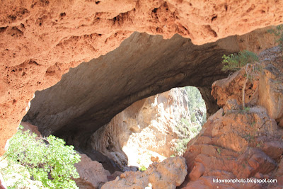
183 ft high, 150 ft wide, 400 ft through the tunnel
(the tree on the right side of the photo is a full size tree)
The Saturday of Memorial Day weekend, my husband and I went on a 1 day road trip aimed at 1) Getting out of the city, and 2) getting out of the heat. It may be late spring in some places - but it's full-on summer here in the desert. Other than those two goals, and a need to be home that night, we didn't have a plan. We left town on a route headed towards the high country (guaranteed to be at least 20 degrees cooler).
On our way into the town of Pine, AZ, where we planned to have lunch, I spotted a sign saying "Tonto Natural Bridge". Looked interesting. So, while we stopped for lunch, I pulled out the atlas and looked up the road, and checked out the website on my phone - and figured our car could make it in without getting a flat tire We then committed the cardinal road-trip sin of TURNING AROUND.
We took the paved (although fairly steep) road down to a well-equipped Ranger Station, bought two liters of water, and started down a half mile trail Pine Creek Trail (there are several trails) to the creek valley that eventually led to the bridge.
Disclaimer here - this trail was "challenging". The photos below don't show the really bad sections, as my camera was packed safely away in my hiking pack. If you plan this hike, take 2 Liters of water EACH, something to pack the water in (small backpack recommended), hiking shoes and a hat. This half mile trail took us an hour and a half one way. Sounded like there really weren't any "easy" trails. There are times we only found the trail because of arrows marked on the rocks.
Tree Stump
Alligator Juniper trunk
Rock with Lichen
Lots of tree pieces like this all along the trail - apparently the canyon floods during the rains, and since the canyon is pretty narrow, the water gets pretty fierce.
My husband taking a sun-warmed rock break. Slacker!
Finally! At the creek!
Really cool rock formations all along the trail.
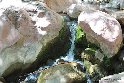
Mini waterfall along the creek
The creek calmed down quite a bit under the bridge
And here's where I freaked out trying to take the last 50 ft of trail and had to turn back. You see, I'm afraid of heights. Chittering monkey afraid of heights. And the trail at this point, climbs to about 30 ft over the rocky, death ridden water. I'm sure there are skeletons under that water. Because, although 30 ft isn't that bad, the rock is very smooth, which you have to walk up the slope (not easy), and then stand straight up and put your feet in cut out steps in the side of the wall. EEK. Well, yes, the 5 year olds' were taking it no problem. And everyone (including the ranger), seemed to think the "trail" was just fine. chitter
Fortunately - we could get back to the parking lot by turning around (see a trend here?) and taking the trail back the way we came. Tired yay. So we ended up hiking a mile total in about 3 hours.
So - we got back to the parking lot, and decided we still had enough energy to take a short walk to the end of the parking lot and take a look over the Viewpoint lookouts. Yes, I know, even higher up - but there were RAILS. And a nice wide path.
This was really interesting, because we found out where the water for the creek was coming from. The Top of the bridge. Yes - the stream runs along the top of the canyon along the center of the bridge, then take a header over the middle of the bridge.
Spoke to a volunteer at this point, and he let us know that the best time to come back would be sometime in October. It cools down a little, and the trails are pretty deserted. We'll be trying the Gowan trail next time - 2200 ft down to an observation platform. The volunteer said the path was "steep". I may bring rappelling gear.


